Pasqua e Pasquetta… che Cas(ent)ino: Damn

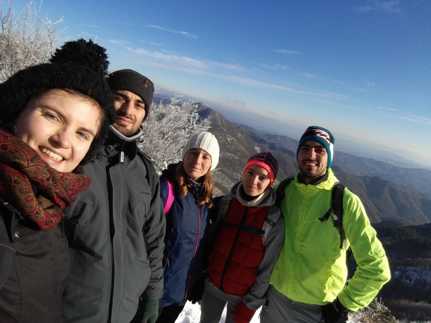
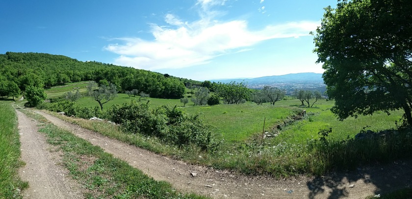
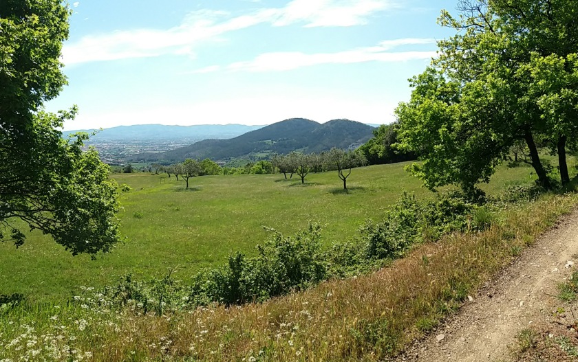
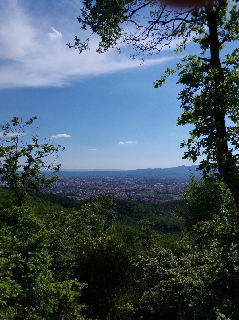
After rain comes sunshine and so it was that a rather rainy Easter day was followed by a beautiful, warm Easter Monday which I spent in the Ridracoli valley.

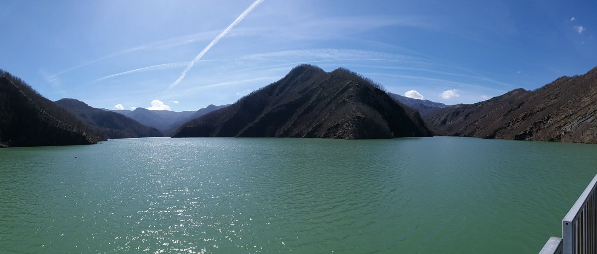
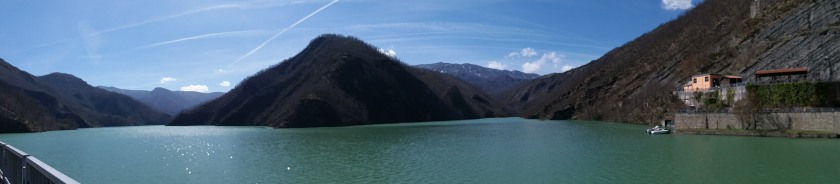
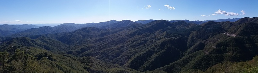
This valley, situated at the core of the Parco Nazionale delle Foreste casentinesi, is known for its dam. Built in the late seventies/beginning of the eighties the dam gave life to an artificial lake of about 30 million cubic meters.

20180402_133142.jpg

If you are staying at Camaldoli and want to visit the Diga (dam) of Ridracoli plan well because following a hiking trail it takes about a day, while by car it is (still) about 2 hours. We, personally, drove around the mountain chain, passing by San Piero in Bagno and Santa Sofia to reach Ridracoli… a bumpy, curvy, long road (and a no go for those who suffer from car sickness) I dare say… but we got there…

Anyway… we might have taken the car but we didn’t escape a good walk. Cars are not allowed to go up, you see, and so instead you either take one of the shuttle busses or go by foot. The bus costs you €4,00 (one-way ticket) and it passes regularly but we choose to walk. You, however, cannot simply follow the road as the busses do… If you want to avoid paying €4,00 for walking you should take the long way following a trail

DSCN1028

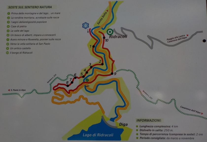
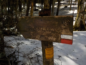
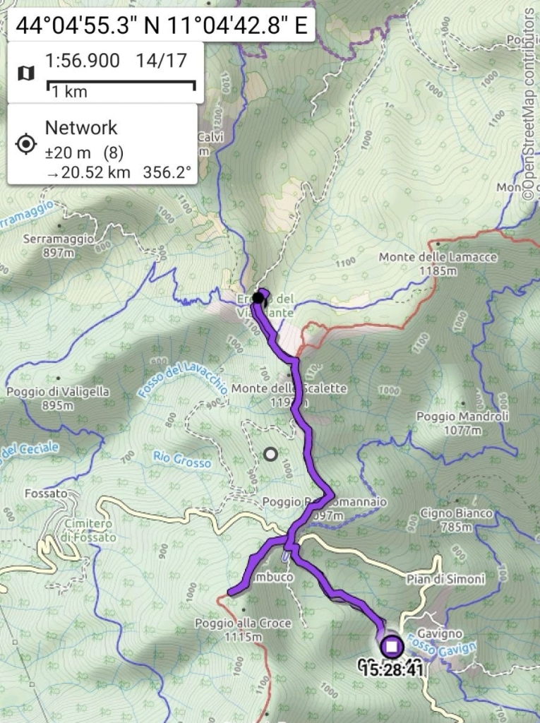
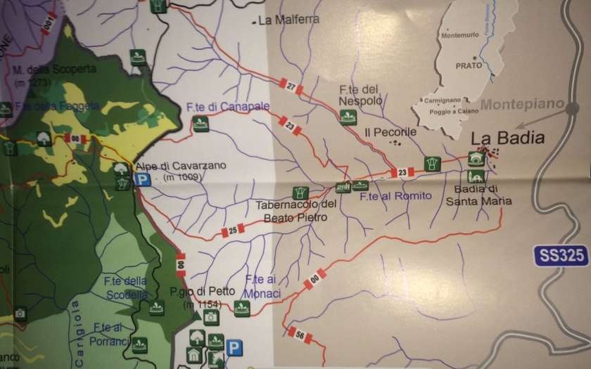
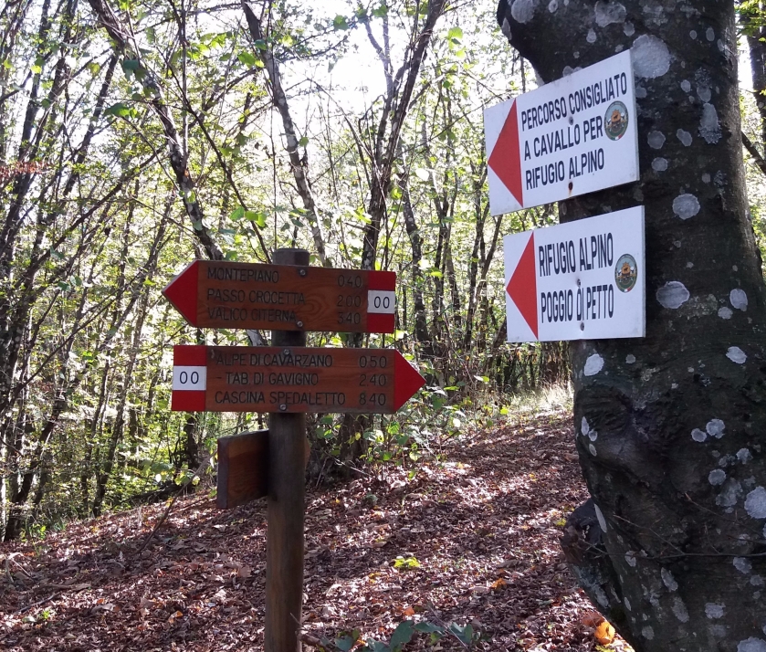
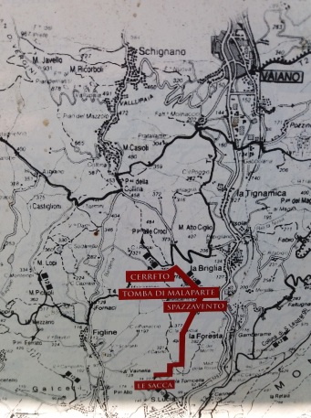
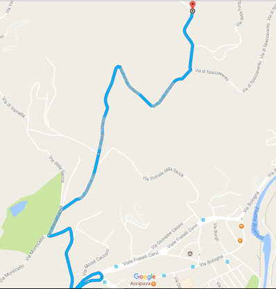
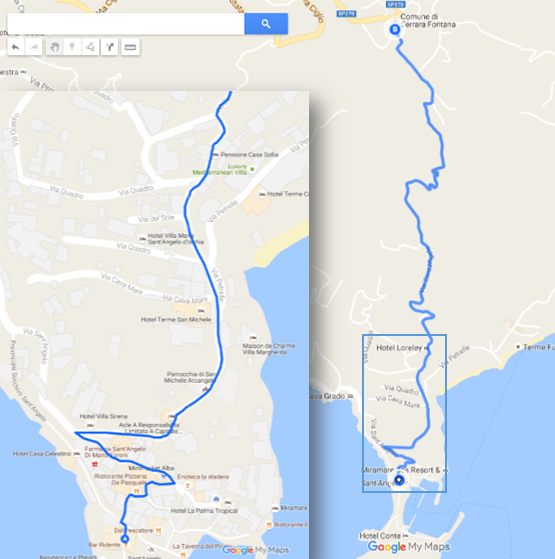
which starts from the Eco-museum of Ridracoli and I would recommend you to also leave you car there. The trail, suitable for both adults and children, creates no specific difficulties and even at a slower pace you arrive at the dam in little more than an hour. Along the trail you can stop and read the various signs (numbers 1-10 on the map) with useful information about the area and the construction of the dam.

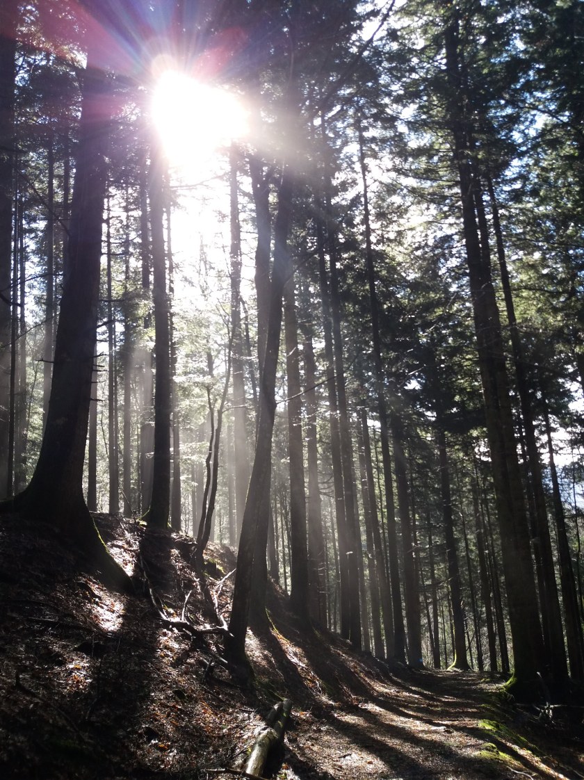
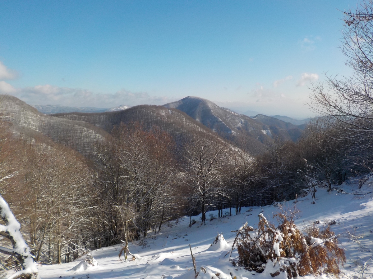
During the first part of the trail (red line) which passes along a hillside (numbers 1-8) it is impossible to get lost but at a certain point you will hit a small creek (corresponding more or less with the info-sign on the map).

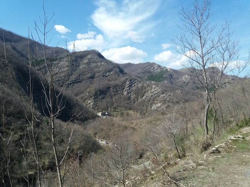
Do not continue up (the left orange line) but cross the little bridge and follow the road, going up (the right orange line). The tricky part of the walk starts as you gradually gain height, when the road becomes long and steap.


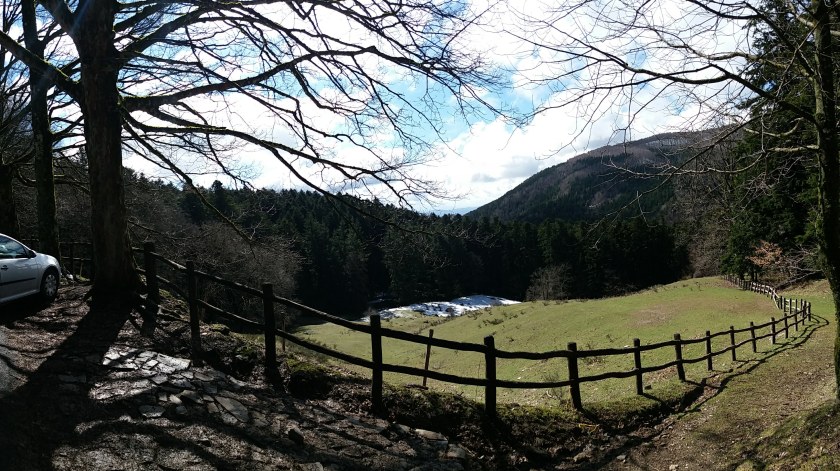
Once you reach a tunnel you know that the dam is very near, pass through it and let yourself be marvelled:

Don’t just stand there but continue to walk over the dam, through the first tunnel and go down the stairs to reach a small beach which is the perfect spot to see the dam from another point of view and more importantly… to take off your trekking shoes, have a well-deserved lunch break and lay back. For those who have more time you can decide to continue to the “Rifugio Ca’ di Sopra” and eat there.  This hostel also offers you bunk beds in case you consider a trekking weekend in the area. Don’t forget to book, though, because the number of beds are limited and ear plugs are also highly recommended :p… or so I have been told.

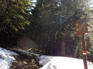
Let’s return to our walk and how to complete the circular trail to get from the dam back to the point where we left the car… Well to start you need to retrace your steps until to the information centre and giving that you loose altitude it goes way faster than going up. Once arrived you should cross the road in front of the ticket shop/bus stop, walk up three steps and to the left of the parking lot a trail starts:

Along the way you will see remainders of an ancient castle (number 9) and its walls (no Chinese walls but still nice).

20180402_151052

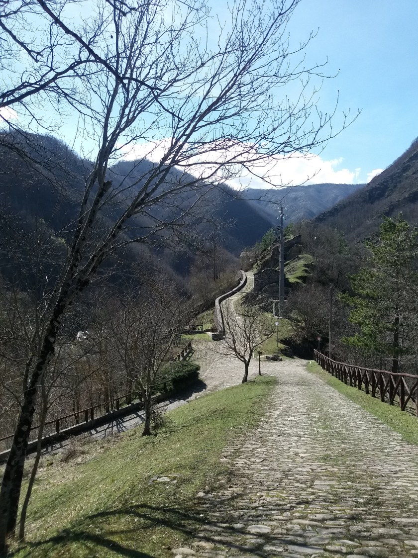
The trail does not lead you to the castle: you will arrive from the road situated to the right of the lantern, in the back of the picture above (where the wooden fence ends) but as you see you can take the a closer look following the road along the wall. To continue your journey to the car, however, you need to go up towards the house and take the trail situated to its left:

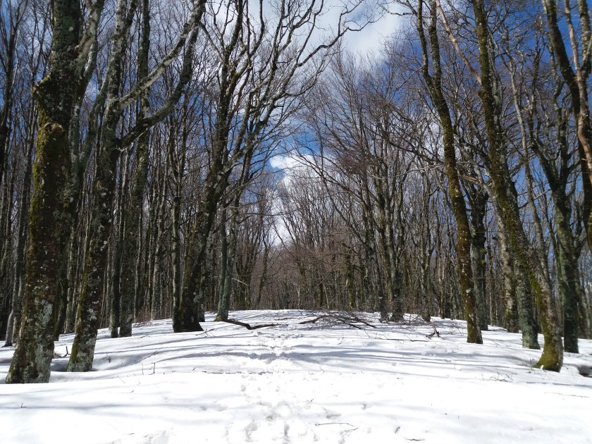
At this point the trail becomes more narrow to subsequently go down

20180402_151518

until you reach this tree

DSCN1027


turn left and continue to go down as to reach the road which if you follow it for 100m will lead you to the Eco-museum.

In its complexity you should consider about 4-5 hours (including breaks and lunch break).


Pasqua e Pasquetta… che Cas(ent)ino! part 1

Longing to break with the work routine or in need of some time away with the Christmas holidays long gone and the summer holidays still far away… well that is how I felt right around Easter. I had already started dreaming weeks before but as usual waited until the last minute to book. Having to deal with fully booked hotels and not responding Airbnb hosts we would probably have stayed home if we hadn’t found this hotel/hostel/restaurant/bar/focacceria, La Locanda dei Baroni, in a small town called Camaldoli, situated in the nature reserve of Le Foreste Casentinesi.

When I say small I really mean small… at arrival we decided to explore Camaldoli and after 20-30 minutes we had about seen it all: the main (and probably only) street, the Foresteria of the Monastery, which hosts pelgrims, the Antica Farmacia, where the monks produce their artisanal liquors, the river and… our hotel/hostel/restaurant/bar/focacceria (really not joking: run by the same family, in the same building).

And that very same first evening we were welcomed by these two adorable deers

20180331_192806

The next morning we woke up to see an all but clear sky but that wouldn’t keep us from doing what we came here for, hiking,… First things first one cannot go hiking on an empty stomach, especially when there are homemade cakes in the room:


The first of two days spent in this area we followed an itinerary which took us up to the famous Eremo di Camaldoli, dotated by Count Maldolo (to whom the town owes its name “Casa di Maldolo”) to the saint San Romualdo, passing by Prato alla Penna, Gioghetto and back to the Eremo/Camaldoli:

We started off following the trail N° 68, which starts behind the post office. It is somewhat steap in the beginning and takes you through the vast woods of this reserve

20180401_101531

to subsequently hit the road. At that point you will find to your right the Casotto Braga. Continue down the road for about 20 min and you will find yourself in front of the Eremo and this vast panorama:

20180401_112501

Be careful, however, and plan well… and unlike us you will find open doors :p. We had to return in the afternoon to visit the site: the Church, the living area of the monks (from behind the closed gates) and the house of San Romualdo:

I fell in love with the fresco’s in the small chapel inside the church:


This was, however, not even half way through our first hike, our voyage continued up trail N°74 which took us to Prato alla Penna.

!keep left when you reach something which might seem a junction until you hit the following

DSCN0964

(at about 10 minutes away from the Eremo)!

It might have been Spring but the scenes threw us back in full Winter mode

The same snow made us change our original hiking plan, moving further up to Monte Penna; instead we took the trail N° 00 (direction Passo Calla/Poggio Scali) to Gioghetto, enchanted by very fairytale-like scenes like these:

20180401_141643


Once you hit Gioghetto (which on itself is not that interesting to see) you turn left

DSCN0976

and go down trail N° 70 which takes you to the backside (the walls) of the Eremo where, in our case, Winter made room for Spring:

transforming me into a flower girl.

Keep to the left, walking along the walls of the monastery to find yourself at the starting point of trail N° 74. Cross the street to return to Camaldoli

following another trail which strange enough has the same number than the one we took in the morning, N°68.  Watch your step (because this one is narrow and really steap) but also enjoy the views. You will pass by a small pond Lago Traversari, la Cappella di San Romualdo and the Cappella della Neve.

to, in the end, find yourself at the Post Office where it all began (very hungry and wanting to take a warm shower).

Let it snow !

December brings cold, wind and snow… well bring it on, Father Winter, because that is not going to stop me from hiking! Ok I might have exaggerated a bit… because in reality I am not that hard core and I really don’t take cold temperatures that well (cold feet and loss of sensitivity in my fingers) but a walk in the snow with clear skies and the sun up high is truly magical.

A walk in winter theme, however, needs to be planned well:

(1) correct footwear, if possible snow boots,

(2) correct clothing: thermal pants and t-shirt, thick gloves and socks, a woolen hat, a fleece sweater and a windproof coat

(3) a thermos with warm drinks (tea, coffee or soup),

and

(4) a cabin or other type of retreat with a fireplace to warm your hands and feet during lunch.

As far as (4) is concerned I am lucky to have a friend who is quite the hiking expert. He took us from below the Tabernacolo di Gavigno up to the Eremo di Viandante, following hiking trails 62 and 00:

IMG-20171231-WA0007

(Please don’t mind the small detour to the left:  even great hiking guides can get lost if the snow hides the hiking trail indications :p).

Starting point of this rather short hike of about 10 km is Gavigno.


The snow may have melted on the first picture but the other pictures clearly show that higher up there was more than enough. We continued up the snowy trail 62 until the Tabernacolo di Gavigno:


to then switch to the famous trail 00 which crosses the whole of the Tuscan-Romagnol part of the Apennine mountains.

This part of the hike (approximately 2,5 hours with stops) is more intense since the trail goes up the mountain following a rather steap pathway:


On the way to the Eremo del Viandante, the cabin where you can eat your lunch by a warm fire (if you are able te start it… I needed some help of a friend who came along), you pass by the Poggio Roccomaio and the Monte Scalette.

DSCN0758

Feel free to take a break once in a while and admire the wonders nature gives us in this period of the year:


Cherish these images because the next time you do the same trail the views may be very different…

These winter scenes kept us going but at a certain point our stomach also wanted something. Luckily we soon reached the Eremeo del Viandante (or more or less :p)

and gave into our hunger.

Given that the sun already goes down around five o’clock it is important to keep track of time so once our stomachs were filled with a good old sandwich, hot tea and home-made chocolat pie we headed back down.

20171203_123446

Nah but we couldn’t leave without a group pic:

20171203_135549

Going down all this snow tempted first one and then another… one snowball led to the next and we got ourselves into a classic snowball fight in which it is important not to loose your hat:

20171203_145249

Head and head reunited we could go home to enjoy well-deserved hot shower to wash the last snow flakes away…

An early Autumn walk: to Poggio di Petto and back

Summer is over… yet no need to complain because Autumn might have caused the leaves to change colour and fall but the temperatures are still high: though mid October during the day it is still 25°C and more. The perfect mix for a relaxing walk… and this time my heart and my feet took me to Poggio di Petto.

Poggio di Petto offers a marvellous view over the Area Protetta di Carigiola, and for those who don’t like walking you can also simply come here by car and enjoy a lunch/dinner menu with typical Tuscan dishes in the Rifugio Alpino di Poggio di Petto. Please remember to book otherwise the view (though breathtaking) will have to do:

20171007_145100

The fact that you can not only book tables but also rooms gives you the perfect excuse to turn a hiking day into a hiking weekend :p.

The walk described in what follows starts in Montepiano and takes you to Poggio di Petto to return once more to the starting point, Montepiano. In order not to tire yourself out too much I recommend to take the hiking trail 00 on the way back:

IMG-20171006-WA0001

You can choose to leave the car either in the city centre or near the Abbey of Montepiano, like we did, and then you simply continue down the road to find the hiking trail n° 23.


On the way to Poggio di Petto you cross the woods, walk through a dense layer of leaves… and how I love that sound.  At a certain point you will pass a drinking fountain: don’t hesitate to take a refreshing sip. Once you have spotted the house below it does not take long before you hit a road and here you turn left to take the trail 00 (direction Montepiano):

Along the 00 you will see two crosses, of which the first is near that road:

20171007_114031

Though at first sight there might not be a sign of a trail I can assure you that there is one going straight ahead. After about 10 min you will encounter the following sign:

20171007_154423

Follow the direction indicated for Poggio di Petto. When you hit an electric wire, you need to continue up the hill to enjoy this magnificent sight:

20171007_121521

If you head left you will see the second of the two crosses I told you about earlier and an even more impressive view:

20171007_124709

If, on the other hand, you turn right you will find Poggio di Petto, where you can halt either to have a warm coffee or to have an elaborate lunch or dinner.

To complete your walk and to return to the car you have to go back to where you found the electric wire, go down the hill and continue down the trail 00, direction Montepiano, for about 1.30h. The way down is quite steap so watch your step!

Elba, sand me all your love!

The island of Elba is a true paradise for beach lovers and every one of its beaches is different: from the typical lido’s with sunbeds and umbrellas to more natural beaches that only the locals know how to reach,

IMG_20170822_185251_052[1]

from rocky to sandy beaches… but not necessarily sandy “white” ones.

Heading from Rio Marina to Cavo, you pass by two very particular beaches:

  • Spiagga di Topinetti:

20170808_141049

with its black sand due to the iron in the soil. The people from the nearby villages used to work the iron extracted in this part of the isle.

  • Cala Seregola:

20170808_142427

with its red sand. This and the deserted mine buildings reveal the mine past of this area. If you want to know more about the former mine industry you can visit the Museo Mineralogico in Rio Marina.

This beaches might be fascinating but the real beaches to visit are located elsewhere. In what follows I sum up the beaches which I found most memorable, each for very different reasons

(1) Stecchi Due

20170812_124004

Stecchi Due is one of my favourites because unlike the beaches that follow this one is not well known among tourists… in fact you could say that this is one of the beaches the people of Elba go to during the summer peak and it is probably due to the fact that it is not that easy to find, but my motto “look and you shall find” proved more than worth while. Entering a narrow passage in the bushes and going down down you find this little corner of paradise with a lot of fishes and very clear water. Do mind the current when the sea is rough. It is best to enter the water either at the right or by means of the little bay on the left, where you see the sailboat.

(2) Cavoli

20170813_101058

The typical image of a tropical beach with white sand and crystal blue water you can find in Cavoli but be sure to set your alarm clock because if you want to find a spot you will have to get up early. Don’t think about parking next to the beach, instead I suggest you to park along the main road which connects the coast towns (then go down a very steap street which takes you down to the beach !follow the signs!).

(3) Sansone

20170814_155341

Sansone might not be sandy but pebbly, the sea water is equally transparant. A perfect spot to go snorkling, especially around the rocks, on the right. If you didn’t have time to pack lunch you can decide to eat something in the recently constructed bar higher up.

(4) La Paolina

20170809_154623

This beach is worth while for the small isle which is situated in its bay. Here this is no pqrkig space, the only option you have is to park along the road and if you don’t arrive early all the spots will be taken. To gain access to the beach you pass through a pine forest. Don’t forget to enjoy a refreshing spritz in the bar of this beach before leaving!


Another year, another island

Last year my boyfriend and I went on a one-day boat trip to Elba and we fell in love with its beaches and crystal clear water so when we had to decide where this year’s summer holidays would take us we could not think of a more suitable travel destination than this fish-shaped island:

mappa-elba


HOW TO GET THERE: by boat from Piombino or Livorno (but it is also possible to go by plane, landing in La Pila )

We personally booked our tickets with the ferry company Toremar 


MOVE AROUND THE ISLAND by car

We came by car because renting a car or scooter for a week does cost. If you don’t have the possibility to come with your own car make sure to set aside some budget for this. Even if there are buslines bare in mind that they are not frequent so a car/scooter could be quite useful.


WHERE TO STAY: Capoliveri

I strongly recommed Capoliveri because it is very well positioned and though crowded by tourists during the summer the prices in most of the restaurants and bars are lower than in the cities by the sea.

20170813_205300

Accommodation: Airbnb

Going to Elba in August is all but cheap so if you have the chance to go in June or September you will save money and also have more space on the many beautiful beaches this island has to offer.

To save some money and have the opportunity to get insights from locals (as in from our host) we booked a room using Airbnb.


WHERE TO EAT:

Ristorante Oasi

Here we spent our first evening in Capoliveri. Good food, very friendly maitre and rather large portions for a small price. I, personally, much enjoyed the risotto nero di seppia: it might not look very tasteful but once you taste it you will understand what I mean.

20170807_220909

Trattoria il Giardino

We had a hard time getting into this place: you have to book days in advance and in order to have space on the roof terrace with a breathtaking view on the bay even up to a week in advance BUT it is an absolute must if you come to Capoliveri and I can reassure you you will not regret it. Prepare yourself to meet the most chatty and comic waiter in history… but no joke he knows his stuff: he explains you every dish on the menu which changes according to what catches of that very day, bought from local fishermen and prepared in a most original colourful and most importantly delicous dishes which talk for themselves:


Cacciucco Blues

If you like to eat various small dishes, tapas-style, you are going to like this place. Make sure you come in time because the number of tables are limited, which we didn’t know but they were so nice to create a table ex nuovo. Very romantic atmosphere!

Uscio e Bottega

The perfect spot for a typical Tuscan aperitive, a “tagliere” with local cheeses and cold cuts accompanied by a wine of your choice. Very friendly personnel and great quality for a small price!


and where NOT to eat: 

L’Orchidea: 

This pastery shop is very well known in Capoliveri for the great view from its terrace but, as far as I am concerned, not so much for its great service. I was quite disappointed by the pasteries which they told me to be amongst of the best of the isle: they cost double, didn’t have much taste and were served by a rather rude waitress.

My very own “Roman Holiday”: no Vespa nor Audrey Hepburn but a good pair of walking shoes and “questa bell(g)a”

For those of you who are unfamiliar with the film, “Roman Holiday”” is a award-winning motion picture shot in the historical centre of Rome, starring Audrey Hepburn and Gregory Peck. Although my stay in Rome was not exactly like the movie I did get to see la città eterna in equally good company, my boyfriend, but in my case it was the girl who carried (read dragged) the guy around (female emancipation hahahaha) wearing our walking shoes.

DAY 1-2: In Rome, do as the Ancient Romans do…

Rome breathes history and I tried to take it all in, in 48 very intense hours of Ancient Rome.

! IMPORTANT !
Before leaving for your Rome trip I would, however, recommend you
to book the tickets for the various sites
and this to avoid long waiting lines.
DO BARE IN MIND that this doesn’t mean that you can enter immediately:
something I learnt the hard way leaving quite late and discovering that buying your ticket in advance only allows you to skip the ticket line not the line to enter but I can reassure you that it goes quite fast.

I started my journey back in time at the Circo Massimo

20170423_122557

(I planned to start at the Colosseo but faith had something else in mind or… in reality the bus since itdidn’t follow its regular course). Take your time to walk around where chariots raced against one another to gain fame and glory… or simply for the emperor’s pleasure.

From one arena to the next… and in this case the most famous one, the Colosseo, in which up to this day people still gather for bread and games: each year there are still concerts in this arena. It is here that you will find the longest line.

It is hard to believe that so many centuries ago they were able to build this immense arena and then to to know that apart from the fights between gladiators and games involving exotic animals they also reinacted sea battles (by !flooding! the arena and introducing real boats).

If you leave this place full of amazement yet with a rather empty stomach I would suggest you to go to the Osteria Angelino or the Taverna dei Quaranta. I personally tried the latter and ordered a typical Roman dish, “pasta cacio pepe”, which will give you the energy you need to make it through the rest of the day.

Our next stop was the most central of the seven hills on which Rome was built, the Palatine Hill,  and the part of Ancient Rome in which the imperial palaces were constructed.

20170423_164802

Entering the complex (using the ticket you used at the Colloseo) you turn to the left to visit the palaces:

One side of this hill looks over Circo Massimo, the other allows you to pear over the Foro Romano from about 40m high.

20170423_164737.jpg

Going down you reach the Foro Romano, surrounded by the ruins of the political centre of the Roman Empire:

DSCN0356[1]

To complete the tour you still need to visit the Pantheon and the Teatro Marcello, where we went the next day.

The Pantheon is one of the best preserved examples of Roman architecture and considered unique in its kind.  In fact it is said that even in our days it would be impossible to replicate a dome of this size.

Inside, the only light comes from the entrance and above, where you appear to see the sky and no, your eyes aren’t fooling you, it is really the sky. This building might have an open roof yet the Romans needn’t fear to get wet on a rainy day since the water evaporised before reaching the ground.

Last, but not least Teatro Marcello, 

20170425_112254

situated in what is currently the Jewish getto.

20170424_224510FOR THE COMPLETE EXPERIENCE we highly recommend a guided tour by night on the Foro di Cesare. The meeting point is at the Colonna Traiana. After walking through an recently discovered underground passage (where a short video will show the different phases of the excavations)you will reach the Forum where your journey back in time will start. By means of beamers you will see Ancient Rome reconstructed before your eyes.


DAY 3: In Rome, do as the tourists do…

When I travel I usually avoid acting too touristy, instead I wish to tune into the local vibe but let’s say that in Rome it is hard to not give into the selfie at the Fontana di Trevi

20170422_180054

5 TO DO TOURISTY SPOTS

  • Piazza di Spagna
  • Fontana di Trevi
  • Bocca della Verità (though I didn’t get the chance to lay my hand in it because the line was way but way too long to perform this quite ridiculous ritual)
  • Castel Sant’Angelo
  • Vaticano


DAY 4: Let’s look at Rome from another point of view

For the past three days I walked through the streets of Rome yet on day 4 I wanted to look at Rome from a different angle. In what follows I present you five perfect spots to enjoy the Roman skyline.

TOP 5 PANORAMIC VIEWS

(1) Parco Villa Borghese

Walk up the stairs next to the Piazza Del Popolo, reach the Pincio, turn, walk towards the terraces and look

20170422_191803

(2) Giardino degli Aranci 

After a relax walk along the Tevere you cross the street and take a steep road up to find a small garden. It is the perfect place for a picnic. In fact we ate the sandwiches we bought in the centre here, far away from the hectic city centre, and what a view…

20170425_142015

(3) Terrazza del Gianicolo

It takes some time to get there on foot but absolutely worth while. A picture tells more than a thousand words:

DSCN0378

(4) Terrazza delle Quadrighe

If you are near the Altare della Patria it is worth while to enter both for this impressive building and view that lies behind, from the terraces (and above if you wish to pay to use the elevators which take you up).

20170423_181009

(5) Palatine hill

To have a beautiful panorama of what Ancient Rome is about, you can’t take a better shot than from the Palatine hill:

20170423_164802

Sleeping out on Sunday is no valid reason to skip a nice hike.

Sleeping out on Sunday is no valid reason to skip a nice hike. Get your walking shoes on, get yourself a yammie sandwich and off you go!

Yesterday was one of those days, you all know them, you make it late the night before and getting up early is no option but you really want to stretch your legs and reach higher grounds. I have to say that I am quite lucky, though, since I moved to Prato I have a lot of hiking routes at only a 15 minute drive away. So even if I get up somewhat late I can still do a little hike and this time me and my boyfriend chose to visit the tomb of Curzio Malaparte, a writer/journalist who wished to be buried on Monte Coste overlooking his beloved birth town, Prato.

20170430_161901

The entire hike takes about 3 hours (including lunch break) and starts on a small parking space which is to be found on the left hand side driving up Via della Fontana (where the road is no longer asphalted).

Immagine

Continuing down the road you will reach a T-junction where you will find an information sign regarding the hiking path you will follow when you turn right.

The beginning is a bit steep but very doable. Going up you slowly realize how high up you really are… and then you finally reach the tomb of Malaparte (at 529m):

to read how proud Curzio Malaparte was of his origins.

Walk back and take look at that city he loved so much:

At that point you can either choose to have lunch with a view or to continue taking the path to the left of the tomb and picnic on the big rocks amidst nature. You’ll need the energy to complete the hike to return to the car but be sure it is worth while and you will understand why once you see a house, turn to left before the house (crossing what seems to be a driveway) and follow the road:

20170430_15165220170430_151538

I couldn’t resist and I threw myself on these seemingly evergreen fields with no living soul (except for my boyfriend) to be seen or heard… The scenery seems one of a surrealistic painting or a picture out of a magazine and I would have loved to stay there forever… with the sun on my face, the smell of grass and the sound of humming bees but we had to return some time.

If you continue you will hit a house and you might think to have found a dead end but in reality the path continues (simply cross the garden of this house and turn left). After half an hour and a last look over the hills

20170430_161055

you will be at the car.

I hope you will enjoy it as much as I did!

Castello Aragonese: walk where so many have walked before

Ischia is more than sunny beaches and spas and it would be a shame to leave this island without having seen the Castello Aragonese in Ischia Ponte.

  • bus stop: Ischia Porto and then bus 7 (but if you don’t mind walking you can also go on foot in about 15 min)
  • entrance fee: €10,00 (well-spent)
  • duration of the visit: 1-2 hours

The current structure of the castle is the work of the Alfonso V of Aragon (thus giving it his name): he expanded the existing castle built in the days of the domination by the House of Anjou and connected it to the mainland by a wooden bridge which was subsequently replaced by the current stone one. Having crossed this long stone bridge with romantic streetlights you pass the main gate and hit the ticket office. Once you have your ticket you can start to explore… guided by a map with useful information about what you will get to see (indicated by numbers). At that point you have two options: you can either take the elevator which takes you to the beginning of the walk described on that little map or you can go on foot (to –in that case- find yourself at the end of that walk). One or the other… this is the view that awaits:

20160614_131934

For me this fortress was simply mind-blowing, from the moment I set eyes on it and even more when I entered this miniature city. Since the Castello Aragonese is so well preserved you really feel thrown back in time, walking in the footsteps of medieval princes, dukes and monks.

I will let my pictures do the rest of the talking because, as they say, pictures say more than words:

Reaching higher grounds

In what follows I wish to share with you two beautiful hikes, one planned the other by accident (I’ll explain later :’) ). You do not need professional gear… though wearing good walking shoes (also good running shoes) will only make the walk more pleasant. I do recommend doing these hikes in the morning, at least in summer time, because with the sun walking uphill becomes more challenging and you’ll need to take more breaks.

OPTION 1: Up Mount Epomeo

duration: a 4-5 hour hike (including the lunch break)

starting point: Bar Epomeo (Fontana)

map:

mappa-monte-epomeo

itinerary:

From the bar (across the street from the bus stop) you need to walk Via Francesco Trofa in the direction of the church and take Via Epomeo which you will find at your right hand side (shortly after having passed the corner). Here it all begins, though I have to say the first part of the climb is not that impressive since you walk up a rather steep asphalted road with little to see. Once you pass the restaurant A Cuieta the road will become sandy and you can start to enjoy the surroundings:

20160615_113657

When the sandy road starts to get rockier and the real climbing begins you know that you are almost there:

20160615_115745

And then, there you are at 789 metres above the sea level (“KING (QUEEN) OF THE WORLD”)

20160615_115938

and what a view:

20160615_120103

Since the space on the top is quite limited you cannot stay long so off you go again after 10 min. Having reached the top at lunchtime my stomach started to protest at that point. Luckily there is a restaurant near the top, La Grotta da Fiore, which I, unfortunately, had not expected to find at that height… leaving me to eat the lunch I had packed that morning but in a nice spot which I recommend you to see. Enter the restaurant (don’t worry the personnel is used to it), walk through the dining area, open the door at the end and you will find a beautiful sea view (which you can admire without any time pressure).

To head back to the civilised world you go down the sandy road until the sandy road splits in two. If you go to the left you will return as you came. If, instead, you turn right you will descend passing by the Pietra dell’Acqua (as you see on the map).

I have to add that it did get tricky at a certain point: it got really steep and I did slip a few times. Important to add, however, that during the last part you are protected from the sun by high natural walls of sand covered by bushes and trees.

OPTION 2: Sant’Angelo: up close and from high above

duration: 3 hour hike

starting point: Bar/Gelateria Ridente

map:

mappa-santangelo

From Bar Ridente in the port you walk towards the Provinciale Succhivo Sant’Angelo, turn left and after a few meters right. At the end of the street you turn left and keep climbing… for a whooooooole while, no kidding. The road might not seem long but it is very steep, making it a quite intense hike (given also the heat at that period of the year). I say this because I started this hike in search of a church square which offers a marvellous overview of the coastline of Sant’Angelo, not knowing that how far (up) this church was, as in that it was the main church of another town, called Serrara Fontana, at 360m above the sea level. This rather unexpectedly long search for a mysterious panoramic point would have been a bit easier had I worn good walking shoes instead of silly sandals… I also suggest to take some food along: for example, in Sant’Angelo (the first part of the walk) you will pass some grocery shops where you could buy a snack or a tasty sandwich. Silly me had to go all the way to Serrara Fontana to eat something (I was starving at that point) and the only place still open was a rather strange looking bar. Luckily someone gave me instructions on how to reach a supermarket (walk through the gateway, go to the right and walk for about 50 metres and you will find it on your left hand side) where I bought an oh so tasty sandwich for only 2,5 euros which I ate looking at this beautiful scene:

20160613_130342